Hikes, scenery, and a beer of course
A visit to Glacier Country takes you way up north to the remote reaches of northwest Montana, where the deer and the antelope, and the moose and the mountain sheep, and the bear play. Glacier National Park, named for the rapidly disappearing glaciers that once filled vertical mountain valleys is a gorgeous slice of outdoors. There were 150 glaciers in the area of the park in 1850 but that has dwindled to about 25 now — all of which are getting much smaller as time passes and the climate changes. Some speculate that all may be gone by 2030.
Beautiful hikes, scenic drives, the great outdoors, and a good beer or two are all easy finds. We based out of a spot in the road called Polebridge west of the park on the north fork of the Flathead River that offered an off-the-grid hangout at a fraction of the going rate for staying in the park and is a short, scenic drive from the west entry point. We used the Going-to-the-Sun Road as our connecting route from one side of the park to the other — it had just opened for the season for our June visit (deep snow keeps it closed most of the year). There are a multitude of hiking routes but we picked out four that were a match for our crew’s dayhiking desires.
Click on any image in any of the following galleries to enlarge the image and open a slideshow that you can scroll through to get an idea of the beauty of the park, what you may see along the drive and along the trail, and where you might find a nice craft beer.
Around the Park
When it is open, the Going-to-the-Sun Road offers a spectacular drive climbing up to Logan Pass at nearly 6700 feet (2042 m). This is the highest point you can drive to in the park. The mountains above reach up to 10,479 feet (3,194 m) and there are 150 peaks over 8,000 feet (2,400 m). It isn’t uncommon for the pass area to get100 feet (30 m) of snowfall in a given year so the road is typically only open from mid-to-late June until mid-October.
Avalanche Lake Hike
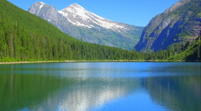
The hike to Avalanche Lake is a steady climb along beautiful Avalanche Creek. This turned out to be the only trail where I encountered a bear — he came crashing across the trail in front of me and disappeared before I could get my camera to my face. The route shown is about 6.2 miles (10 km) in and out to the upper end of the lake.
Fish Lake Hike
Fish Lake is another pretty lake — smaller with lots of lilly pad action. The trail follows Snyder Creek up to Snyder Ridge. The route shown is about 5.2 miles (8.4 km) in and out.
Redrock Falls
Redrock Falls is a colorful spot of redrock that contrast with most of the geology I noticed at Glacier. The route parallels Swiftcurrent Creek and passes two small lakes. The route shown is about 7.5 miles (12 km) in and out.
Two Medicine Hike
This is the most difficult (not technical) of the hikes due to the elevation gain. We were caught in wind and rain so we didn’t get the full effect of the view from the top of the hike. The route shown is about 7.3 miles (11.7 km) in and out and the route in climbs about 2400 feet (735 m).
…. and a beer or two
What good are all those hikes without a good beer or two. We only hit one of the nearby breweries shown on the map above although we invested in our share of carryout from a number of area breweries while at Polebridge. The Great Northern Brewing Company in Whitefish, Montana is right in the center of the town.


Leave a Reply