
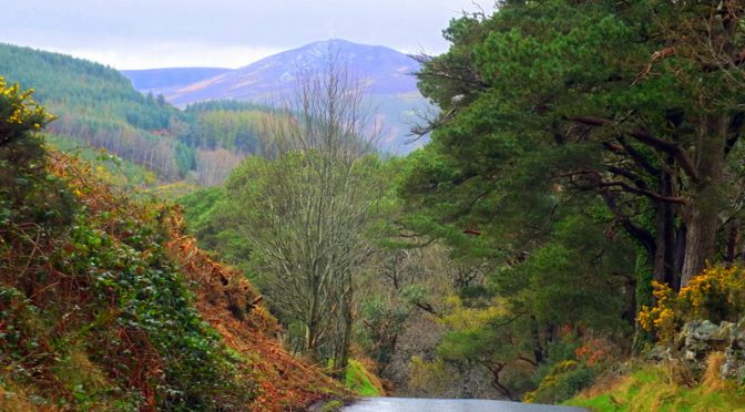

On the eastern coast of Ireland stretching south from Dublin are the Wicklow Mountains (Sléibhte Chill Mhantáin in the Irish), the largest mountain range in the country. Rising from the Irish Sea to a highest altitude of just over 3000 feet (925 m), these are largely granite mountains shaped by the effects of the last ice age. The mountains are covered intermittently by heath, bog, pine, and deciduous forest. These mountains have been inhabited since prehistoric times yet remain sparsely inhabited to this day. This is the setting of the Wicklow Way.
The Wicklow Way (Slí Cualann Nua in the Irish) was Ireland’s first National Trail and extends for about 81 miles (131 km) between Marlay Park in the southern outskirts of Dublin and the village of Clonegal to the south.
Trek Planning

In planning my multi-day trek, I had several considerations including reliance on public transit services, my bias toward frugality, my desire to carry a very light load, and my interest in sampling some nice beers along the way whenever that proved practical. I planned for five days of walking at about 12 miles per day and targeted lodging locations accordingly. There are a few hostels along the way but I quickly found out that despite planning many months in advance, the hostels at Glendalough and Knockree were already fully booked — I was told that even though I was hiking in off-season (March) that these hostels tend to be used for school outings during that time of year. I was able to book the private hostel near Roundwood and the other nights I used country B&B’s and on one night, an Air BnB. The link I gave above to the Wicklow Way has a variety of good logistical information but it did not seem to be comprehensive — I found additional options that they didn’t cover.
Public transportation was also a bit of a puzzle to figure out. I settled on taking an afternoon commuter train south from Dublin to Rathdrum. I booked two nights at nearby Glenmalure where my landlady Maura had agreed to pick me up at the Rathdrum rail station and to give me a ride the next morning south to where I would begin my trek at Aughrim. One other challenge was that I could not find a place to stay for my budget along the route near Knockree. I was able to improvise by finding a country bus line that came reasonably close to the hike route that brought me to/from the coastal town of Bray (there is a brewery in Bray!) where I stayed at an Air BnB. Once I reached the end of my hike at Marlay Park, I caught a Dublin Bus from there to a nearby Luas tram station to get to my accommodations in the city.
Traveling light for me meant an oversize daypack, fast-dry clothing layers, minimalist toiletry kit, my Chromebook, camera, water, and rain gear. Food did not turn out to be a problem. Breakfast came along with the accommodations and I would carry away a piece of fruit and maybe a roll for lunch. All of the places I stayed the night were close enough to a pub or two for dinner and finding a beer or two to try.
Backpacking may provide an option for those who don’t mind carrying a heavier load. There are three rudimentary huts called “bothies” along the way that can be used as shelter and there are camping options for other nights. The bothies are stewarded by a group called Mountain Meitheal and are constructed with three sides, a pitched roof, and a raised platform that can sleep four or five people.
Following are notes from each day of the trek along with photo galleries. Click on any photo to see it larger and to open a scrollable slide show
Aughrim to Glenmalure (via Iron Bridge)
The rain would come and go on the days I was on the trail and it had come when I set out from Aughrim. Aughrim is just off the Wicklow Way, but my plan was to visit a country brewery near there and then follow a side route to pick up the main route at a place called Iron Bridge. Doing this meant missing a section of the main route between Clonegal and Iron Bridge.
Acton’s Country Pub & Brewery, within a small resort called Macreddin village offers an organic stout and lager. While described online in several places I had seen as a microbrewery, the beers are in fact contract brewed by White Gypsy brewery in Templemore.
Glenmalure Lodge is part of a small grouping of buildings in a remote valley and is both a lodging place and the place for lunch or dinner. I was staying at Coolalingo B&B but I enjoyed the warm fire, dinner, and a couple of pints there after a day of wet walking.


")


Glenmalure to Glendalough
There is a scenic descent to the lakes at Glendalough that takes you past photogenic ruins of St. Kevin’s monastery. Near the ruins is a place called Casey’s Bar & Bistro in the hotel there. There is another warm and welcoming fireplace there and they were serving excellent brews from Wicklow Brewery in nearby (if you have a car) Red Cross. Just past Glendalough I found B&B accommodation at the Laragh Mountain View Lodge near the town of Laragh. Shay and Kerry were excellent hosts.
Legend has it that Hollywood, California takes its name from the much older village of Hollywood in Ireland. Coincidentally, if you have seen the movie Braveheart, you’ll have a good sense of what the surrounding countryside looks like along this part of the route. Much of Braveheart was filmed here with this part of Ireland standing in for Scotland.


Glendalough to Roundwood
Lus Mor near Roundwood provided hostel-like accommodation that served my needs well. A couple of miles hike on country roads brought me to Roundwood proper where I found food and drink at the Coach House and the Roundwood Inn. Luckily, one of the other patrons stopped for me in their car as I was hiking back up the hill to Lus Mor in the dark and rain after dinner and took me to the inn.


Roundwood to Knockree (Bray)
The walk in the fog up over a high peak called Djouce was both beautiful and surreal. Eventually, a descent leads toward views of Powerscourt Waterfall the tallest in Ireland at 397 feet (121 m). I was unable to find affordable lodging near the route so I hiked to a bus stop and caught a bus into Bray where I stayed at an Air BnB. Bray is home to the Wicklow Wolf Brewery (sadly it was closed during my visit), a Porterhouse Brewery pub location, and a venerable drinking spot called The Harbour Bar (once called the “Best Bar in the World” by Lonely Planet).


Curtlestown to Marlay Park, Dublin
The last leg features scenic, wide-open country that blends increasingly with farm meadows and fields. Once back in Dublin, it was not difficult to find a nice beer — read all about that in my story called Beery Dublin.


Photo Credits: Acton’s Pub, A. Fanti, Claire Lam, David O’Kelly, Nell Pilgrim, Mark Broderick, M Conway, Liviu Bunta, Thiego Azevedo, Paul Gartland, The Harbour Bar, Daniel Byrne
Leave a Reply