
Beer Hiking & Other Explorations in the Cruces Basin Wilderness
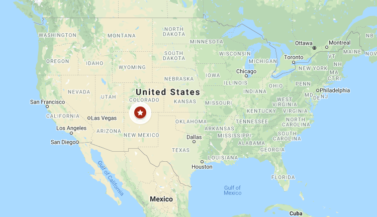
Every time I told someone I was going to check out the Cruces Basin Wilderness, the inevitable question came back, “is that somewhere down by Las Cruces?” Las Cruces is well known in New Mexico as the city way down south just before you get to El Paso, Texas. On the other hand, the little known Cruces Basin Wilderness is about as far north as you can go in central New Mexico, nearly on the Colorado border northwest of Taos.
This is high, remote country. Reaching a boundary requires driving on a dirt, forest road for well more than an hour. We saw a couple passenger cars back there (they must have been rentals) but I would surely recommend decent clearance and traction on all four wheels. you are generally in the Carson National Forest along the way and once you skirt past San Antonio Mountain (one of the highest, stand-alone peaks in the country) there are many dispersed camping spots.
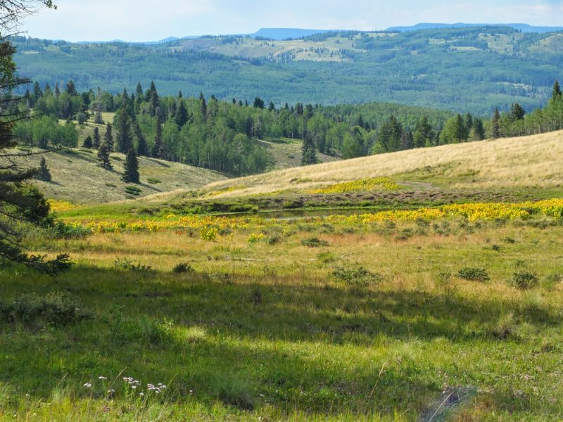
The Continental Divide Trail, on its way from Canada to Mexico, hugs close to the western edge of the Wilderness Area in this part of New Mexico. Much of the Cruces Basin sits above 10,000 feet (3050 m) altitude and is carved by modest canyons – many with mountain streams that run year-round. Canyons, and ridges are covered with mixed fir and aspen forest frequently broken up by large grassy meadows. There’s no better description than to say that this is gorgeous country.
For me, this was an exploratory weekend to somewhere I’d never been to find out what it takes to get there and what the ‘lay-of-the-land’ is like. We picked a couple of interesting trail routes to explore. Cruces Basin is formed by multiple creek drainages that descend from the high ground of the Continental Divide to the Rio de los Pinos. A couple of these have trails that follow the canyons. For me, the maps I found of the area were not real helpful – roads would be identified that didn’t seem to exist any longer and trails on the ground did not always show up on the map. I also learned that warm clothes are advisable for night time, even in the dead of summer. I crawled into my sleeping bag early just to stay warm.
Cruces Basin – Osha Canyon Hike
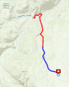
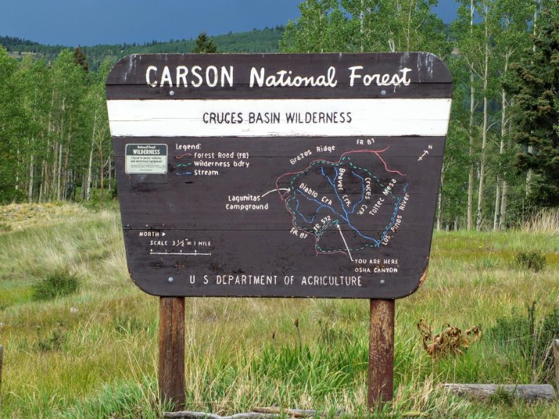
There is a Forest Service campground on many maps labeled as “Cruces Basin Campground” that as far as I could tell does not exist any longer. The place marked on the map was our take-off point for a hike descending down an old road into the Cruces Basin. The map I had shows this road going all the way to the canyon bottom, but I found that it ends in a pretty meadow where there is a sign demarking the wilderness boundary. From there, a single track continues the descent through dense forest.
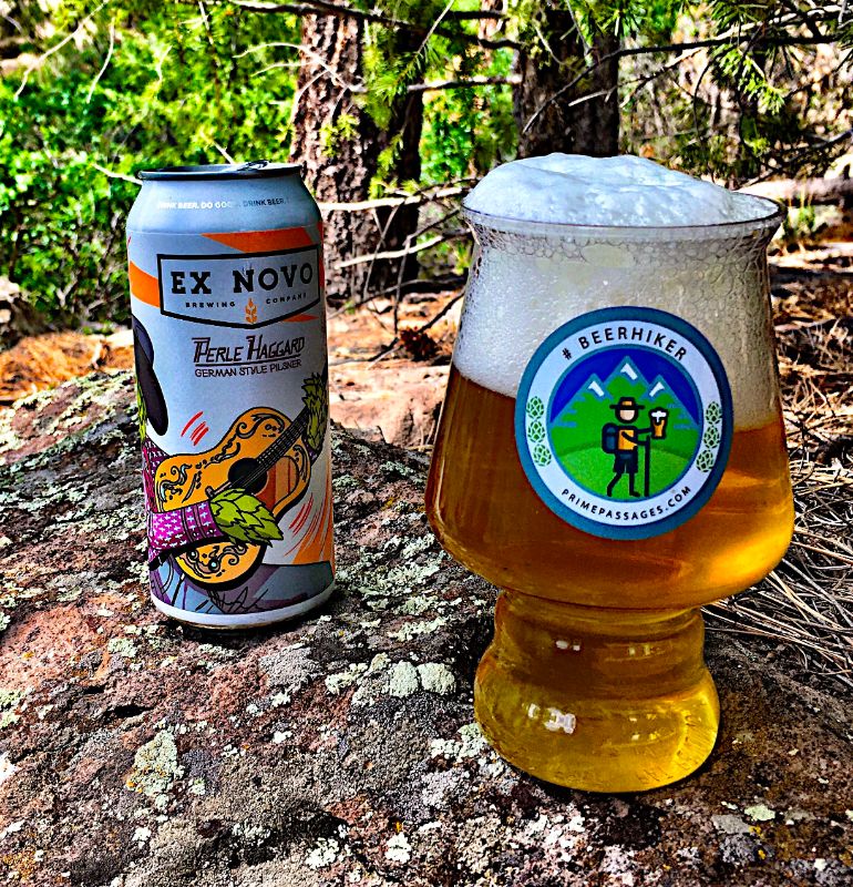
The second half of the hike was a steady climb back out and ended with a well-deserved Ex Novo Perle Haggard Pilsener with a dinner of Tika Masala, fruit, and Nutella bread from Minnie Bakery in Los Alamos. Ex Novo is a brewery in Corrales, NM with a unique story. A guy with NM roots named Joel Gregory founded Ex Novo in Portland in 2014 and did well enough there to conceive building a 20 bbl production brewery back in New Mexico that came online last year. Perle Haggard is a pleasant drinking beer with a fun name and a creative label. I’d love to have the chance to hear the whole Ex Novo story and the twists and turns of their time in New Mexico someday.
You may click on any gallery image to see it in a larger format and to open a slideshow viewer that lets you scroll through larger versions of all images.


Continental Divide Trail Day Hike
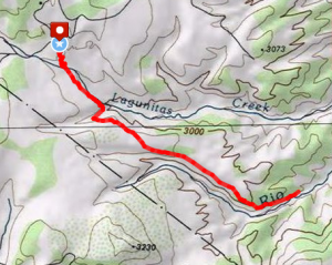
On the southwestern corner of the Cruces Wilderness, there are two modest Forest Service campgrounds called Upper and Lower Lagunitas. The Continental Divide Trail passes right through both of these as it snakes between the several small lakes and ponds that dot the landscape here. We hiked south from the lower campground to sample the trail. This is pretty country that gently rolls over small ridges and through aspen forest and meadowlands. A curious feature of the trail is over-frequent rock piles that presumably are someone’s idea of navigational aids.
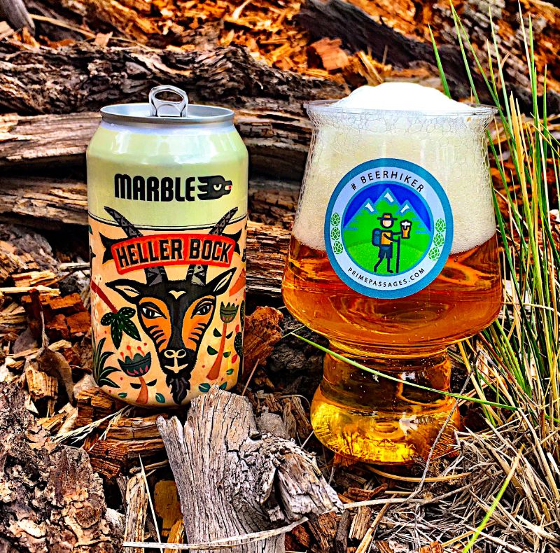
This hike was topped off with a very nice Heller Bock, a seasonal from Albuquerque’s Marble Brewery. I thought this was an excellent rendition – a clean-drinking, malty brew with a nice balance of hoppiness.


For more stories about hikes and beers in New Mexico, CLICK THIS LINK.
Leave a Reply