
The Ute Indians called the Spanish Peaks Huajatolla (pronounced Wa-ha-toy-a), meaning “two breasts” or “breasts of the Earth”. For travelers on the old Santa Fe Trail, these were the first big peaks they would see signaling the beginning of a transition from traveling on the plains to entering the mountain west. For me on this trip, they provided the backdrop for a relaxing Spring weekend and a hike in the forest.
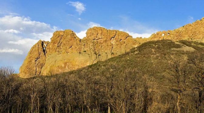
The Spanish Peaks were formed by volcanic uplifts eons ago and the area is somewhat unique for the many prominent intrusions (also called volcanic dikes) that injected themselves upward into the landscape. Up to 400 of these rock formations radiate out from the peaks and given that they are very hard rock, the land around them has eroded away while they rise out of what remains like long spines.
We took a scenic route up from New Mexico that travels up and over the Sangre de Cristo mountain range before dropping into Cimmaron Canyon. It struck me that this could be a good brewery road trip someday as we passed by breweries in Los Alamos, Rinconada, Taos, Angel Fire, Eagle Nest, Cimmaron, Raton, and Trinidad along the way. We stopped at the Blu Dragonfly Brewing Company in the town of Cimmaron for lunch and I enjoyed a nice dunkel with a “Moink” (park pork, part beef) BBQ sandwich. The server told me that much of their business derives from the nearby Philmont Boy Scout Camp backcountry facility.
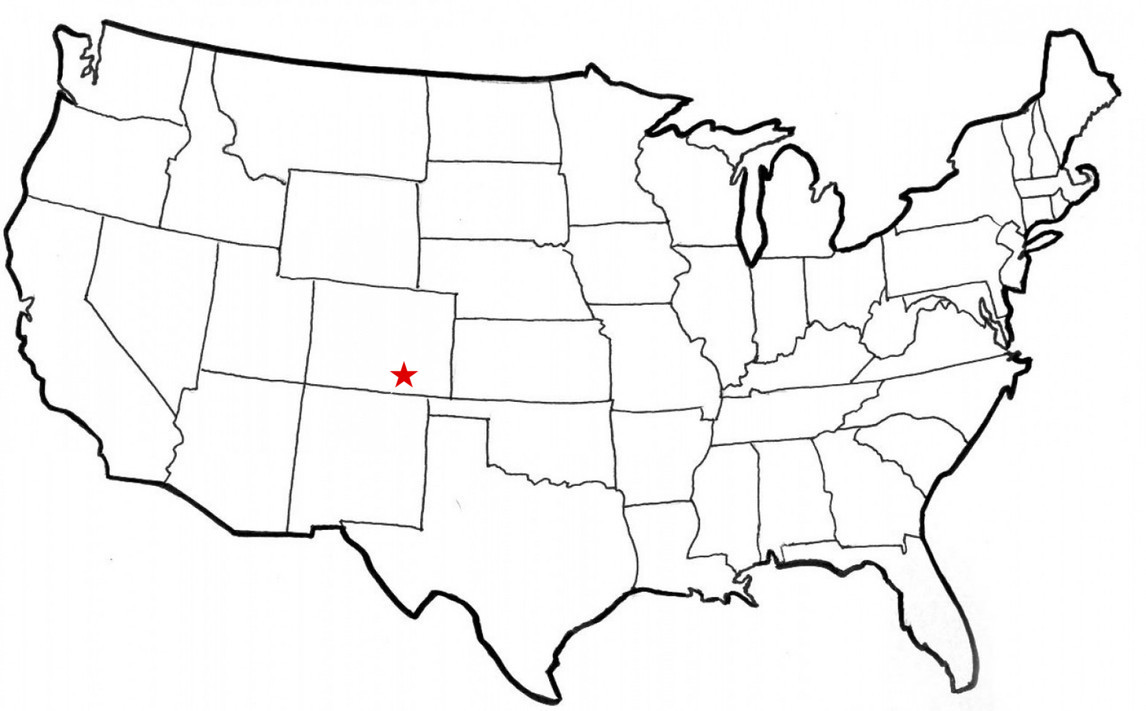
The small city of Trinidad is the first place you come to across the Colorado border from Raton, NM and is the eastern terminus of what is called the Highway of Legends (CO State Highway 12). This is a scenic, mountain highway that heads into the Spanish Peaks country along the Purgatoire River and the southern flank of the Spanish Peaks. It climbs to 10,000 feet altitude at Cuchara Pass before descending to the villages of Cuchara and La Veta. We stayed at a small place along the streamside in Cuchara.
Thanks to an interesting smartphone app called Travel Storys we did get exposed to a legend or two along the way. The Byway is home to unique geological, cultural, and historic features and includes a myriad of legends from the Native Americans, the Spanish Conquistadors, and the pioneers, miners, trappers, and ranchers who explored and then settled this region. A fellow guest told me about the Travel Storys app, and being a gadget guy I downloaded it. It is pretty slick — once you activate it, it monitors your geo-coordinates using your smartphone’s GPS capability and automatically plays short narratives that match the place where you are. It was quite helpful in learning about the history and geology of the places we were at. If you enjoy innovative apps, check it out. They have routes all over the country.


The Dikes Hike
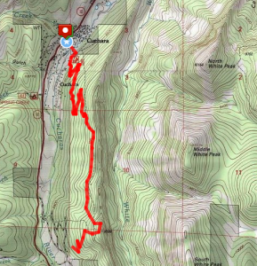
No, not that kind of dikes. A hike that started near where we stayed climbs up one of the long ridgelines that towers above the valley and then follows it just below its crest. I hesitate to call this particular ridge a dike though because I read somewhere that it is really a sedimentary uplift – far too technical for me. The forest is pretty there and there are frequent openings to big views across the valley.
The hike can be done as an out-and-back (as we did) or there is the possibility to put a car at either end and do it one way.
You may click on any gallery image to see it in a larger format and to open a slideshow viewer that lets you scroll through larger versions of all images.


")


Beer Notes
We stopped at the grocery in Trinidad for some beers and there were plenty to choose from. Not being a Colorado beer expert, I gravitated toward my favorite style – darker lagers. Without looking to close, I picked up a six of Colorado Native Amber Lager and we headed into the hills. Inspecting the beers after I popped one when we arrived at our lodgings, I saw that the brewery was the AC Golden Brewing Company. Golden sounds like Coors-town to me so I Googled to see if this was some Coors trained off-shoot. My first impression was that this is a very nice beer.
Someoneone associated with Golden whose initials are AC — hmmm — who could that be? Yes … it turns out that must be Adolph. AC Golden is a subsidiary of Miller-Coors that was founded in 2007 by taking over Coors’ 30 barrel system pilot brewery in Golden. It is tiny compared to its owners’ production breweries and is reportedly run quite independently but it apparently does get support from the distribution infrastructure of its parent. My antennae were up so I made a quick search for the expected derogatory comments by big beer haters. Surprisingly, not much popped up. Interestingly, this brand is only sold within Colorado (I brought some home) and sources all of its ingredients from within Colorado so it is pretty “local” depending on how you define that. I did find a nice article on the Colorado Craft Brews blog profiling the brewery that I recommend if you are interested in more details. Not “craft”, but definitely a satisfying artisanal beer I’d say.
Also worth mentioning on the trip was a lunch stop on the way at Blu Dragonfly Brewing Company in Cimmaron, New Mexico – not too far south of Spanish Peaks Country. This is a laid back, small town place with pleasant outdoor space. They served a drinkable dark lager.


Leave a Reply