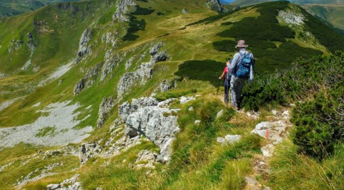
A hike to the summit of Crna Glava and a route known as Katun Road were two more great opportunities for hikes and beers in Montenegro. Crna Glava (‘black head”) at 7,018 feet (2,139 m) is the highest summit in the Bjelasica range, most of which resides in the Biogradska Gora national park. Katun Road is a collection of more than 100 miles (160 km)) of hiking and mountain biking routes that pass through more than thirty highlands “katuns” – more about that later. Our base for these hikes was a pleasant and interesting rural household near Lubnice which I’ll write about as well.
[This post is part four of a six part story about hiking and beer culture travels in Montenegro. Click here to view an index of the articles published to date. Subscribe or follow on Facebook to receive additional installments]
All of these hikes in Montenegro could be challenging in my book — I was humbled more than once by yet another long, steep, uphill jaunt. At the same time, they all offered different environments, viewscapes, and charms. These are all located in very remote places, so they are, with few exceptions, the kind of beer hikes where the beer waits chilling for you at the end of the hike at basecamp. In these rural areas, Nicsicko seems to be the dominant beer brand.
You may click on any gallery image to see it in a larger format and to open a slideshow viewer that lets you scroll through larger versions of all images.
Crna Glava Hike
A winding, rugged drive from Lubnice to Senića Katun brought us to the start of this loop hike. The climb up to a high ridge begins immediately. Following the ridge up leads to Crna Glava from which there are expansive views in every direction. The terrain features huge meadows with wild blueberries everywhere – they were good and ripe in late August. We frequently saw people in small groups combing the mountainside to collect them. A team of wildlife biologists we encountered was doing fieldwork cataloging natural resources related to Montenegro’s attempts to join the European Union. There are several glacial lakes along the way — we passed two of them — Lake Ursulovačko and Lake Pešića. Lake Pešića was near the end of the hike and is a popular swimming hole.
Lubnice Farm Stay
There is an ongoing effort in these remote mountains to provide economic opportunity to residents by their providing services to tourists. Throughout the hiking itinerary, accommodations tended to be at small, family-run establishments. We were well-fed and well-taken-care-of at all of these places.
The Lubnice experience was particularly interesting as we stayed at Kuća Kljajića — a traditional farmhouse built in 1918 that has been renovated to be an accommodation. The Kljajić family lives next door and multiple generations were involved in hosting us. The hostess, Maja served up ample platters of homemade traditional foods that we ate outdoors in an open-sided cabana. Most, if not all the food comes from their farm. Her husband, Milan is a beekeeper so there was always ample honey on the table. Milan is also an accomplished rakija maker and we were treated to several varieties made from different fruits from their orchard and berries from the farm. We brought our own beer, but Maja served a variety of interesting drinks including fresh wild blueberry juice and traditional mountain tea from wild herbs.
Katun Road Hike
I heard more than one explanation of what a “Katun” is as I researched the trip and traveled through many Katuns during the week of hiking. My take-away was that Katuns are mountain farming settlements. Traditionally, they were inhabited seasonally as farmers would bring cattle and sheep up into the highlands to graze for the summers. The traditional use has evolved a bit and some of the Katuns now feature small hospitality businesses providing lodging, food, and refreshments (yes … some may even have beer!). A solid effort has been put into developing these businesses for rural economic development by the Regional Development Agency for Bjelasica, Komovi and Prokletije and their website Katun Roads provides a wealth of information for visitors.
The Katun Road hike we took is part of a much larger system of routes although I never found a map to fully understand this. There is a map link on the Katun Roads website that isn’t working as I write this, but maybe the link will get fixed so I am including it. Our hike wound upward through lush forest along a logging road before emerging into the open at Katun Kaludarske Kape. From there, the route loops up over a 6250 foot (1900 m) summit called Usovište that offers a spectacular panorama.
Read more stories about hiking, beers, and travel in Montenegro


Leave a Reply