


El Cajete translates as something like “shallow bowl” and you can’t argue with that name for this isolated feature within the Valles Caldera National Preserve. It isn’t a place I’ve heard talked about much, probably because of its relative remoteness – it takes seven or eight miles of hiking to get there and back no matter how you approach it. I didn’t encounter another soul on any of these hikes.
Looking at a topo map, a large, unforested oval at the base of Redondo Mountain pops out at you. This piqued my curiosity to take a look at how I would get there on foot. Three options appealed to me so far for day hikes, so I set out to give them a try. Although these routes follow old ranch roads, no non-official vehicular traffic is allowed on them.
The primary eruptions that formed the general landscape of the area happened about 1.25 million years ago and resulted in a caldera that is about 13 miles in diameter. El Cajete is said to have resulted from a relatively recent (less than 60,000 years old) volcanic eruption and it is close to a mile in diameter. Think of it as a volcano in a volcano I guess. The is all high country – the floor of El Cajete sits at about 8700 feet altitude (2650 m). Redondo Peak towers above at 11,270 feet (3434 m).
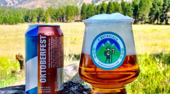
The malty refreshments that accompanied these hikes were Santa Fe Brewing’s Oktoberfest beer and a collaboration beer by Sierra Nevada and BitBurger called Triple Hop’d Lager. The marzen from Santa Fe is a seasonal I’ve enjoyed annually for several years now (6% ABV, 38 IBU). I thought the Triple Hop’d Lager, sometimes referred to as an IPL, to be excellent (5.8% ABV, 30 IBU) – I’ve seen a few reviews that panned this beer and I’d have to say that I can’t agree. Those reviewers need to take a hike I guess.
You may click on any gallery image to see it in a larger format and to open a slideshow viewer that lets you scroll through larger versions of all images.
El Cajete – Route From The East

The first route I hiked involved entering the interior of the Valle Grande – one of the huge valleys in the Valles Caldera National Preserve. The visitor center is a short drive from NM Highway 4 on gravel road. I obtained one of the limited number of permits given out each day to proceed past that point. From there, it is a short drive to the start of the hike which begins at the western part of the Valle Grande. The scenery is gorgeous as you ascend to a high saddle, then drop into a narrow valley before ascending again over the rim of El Cajete.


Via El Cajete Canyon

Approaching the start of this route from along NM 4 it’s hard to imagine what you will encounter. A massive wall shoots up straight in front of you from the East Fork of the Jemez River. I asked myself, “Do I have to go up that thing?” Thankfully, the answer is “no” as there is only a fairly short upgrade before reaching the mouth of a hanging canyon that follows a modest grade up to the rim of El Cajete. This is the shortest of the three routes to reach the rim so I added on by following old tracks to circle around the crater.


Via Banco Bonito

Banco Bonito translates as “beautiful bench” and it is the name for a forested plateau or bench of lava flow to the west of El Cajete. There is a locked gate at the trailhead just off of NM Highway 4 and just beyond the gate is what the National Park Service calls the Banco Bonito Staging Area. They use this as a meeting place for staging various activities – notably, orientations during hunting season. The route passes through a series of meadows punctuated by Ponderosa Pine and Aspen groves. During the last third of the hike in the route follows a steep drop-off to the south that offers some great panoramic views.


For more stories and images from U.S. National Park units CLICK HERE
Leave a Reply